SURVEY INSPECTION
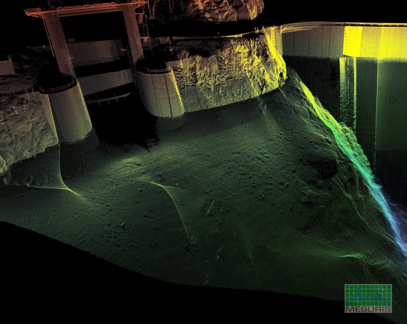
High resolution multibeam echosounder combined with 3D scanner laser system are new topographic and bathymetric generation of sensors. They allow to collect several millions of geo loacalized data points in few minutes with centimeter accuracy.
These sensors are used increasingly as complete and quick solution for the study of the state or behaviors of structure

Dedicated solutions
Our SURVEXTM vessels are transported on site in 1-3 days and are permanently fully equiped with all calibrated and configured sensors. the SURVEX vessel low draught and swath up to 210° of multibeam echosounder allow to map precisely up to water line and above with 3D scanner laser TOPOMETRYXTM HR.
In complex areas where regular vessel launching is impossible, GEOSUB 3DTM subsurface system is the solution to collect high resolution datas in a very short time.It can be deployed on crane hook or any lifting devices. GEOSUB 3D provides high resolution of natural rocks or artificial units without visibility. In addition to real time display, the high resolution DTM produced is ideal for volume computations or underwater placement qualification.
- Survey inspection : quay, bridge, breakwater…
- Natural or artificial rock inspection, density control
- Volume computation, differential
- Isobaths production, cross section
- interactive 3D files BATHYRELIEFTM
- Inspection, auscultation de piles de pont, d’ouvrages d’art
- Inspection, dimensionnement d’enrochement naturel ou artificiel, contrôle de densité
- Inspection de digues, de jetées, état initial, suivi…
- Calcul et comparaison de volume
- Génération d’isobathes, coupes en travers
- Visualisation 3D interactive géo-référencée BATHYRELIEFTM
SERVICES
- VISUAL AID FOR ACCURATE UNDERWATER PLACEMEMENT OF ARMOUR UNIT
- MULTIBEAM BATHYMETRIC SURVEY
- SURVEY INSPECTION
- DATA PROCESSING AND VOLUME COMPUTATION
- SIDE SCAN SONAR SURVEY AND SUB BOTTOM PROFILING
- 3D INTERACTIVE VISUALIZATION
- ELECTRONIC SYSTEM INTEGRATION FOR MARINE APPLICATION
- RESELLER FOR : TELEDYNE TSS, RESON, QPS, MSI and GENERAL ACOUSTICS
HEAD OFFICE AND WORKSHOP
SERVICES
37 rue de l’Océan – 56470 SAINT-PHILIBERT – FRANCE
MARKETING CONTACT :
+33(0)2 97 30 01 55
TECHNICAL CONTACT :
+33(0)2 97 30 08 95
DATA MANAGEMENT AND PROCESSING
Rue de la Terre Victoria – EDONIA B
35760 SAINT-GREGOIRE – FRANCE
+33(0)2 99 23 42 01


